| Sprache: |


|
Land: |


- Auswahl
- Suchen
- Verstecken
- Beschreibung
- Erlaubte HTML-Tags
- Meine Caches
- Empfohlene Caches
- Cachelisten
- OConly-81


 Vereinigte Staaten
|
|
||||
|
|||||


 Größe: kein Behälter
 Status: kann gesucht werden
 Versteckt am: 08. März 2011
 Auch gelistet auf:
  0 gefunden
 0 nicht gefunden
 0 Bemerkungen
 0 Beobachter
 0 Ignorierer
 45 Aufrufe
 0 Logbilder

 Cachelisten
![]() Beschreibung
Beschreibung
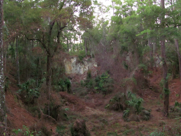
The topic of this Earthcache is the phosphate pit in Rainbow Springs.
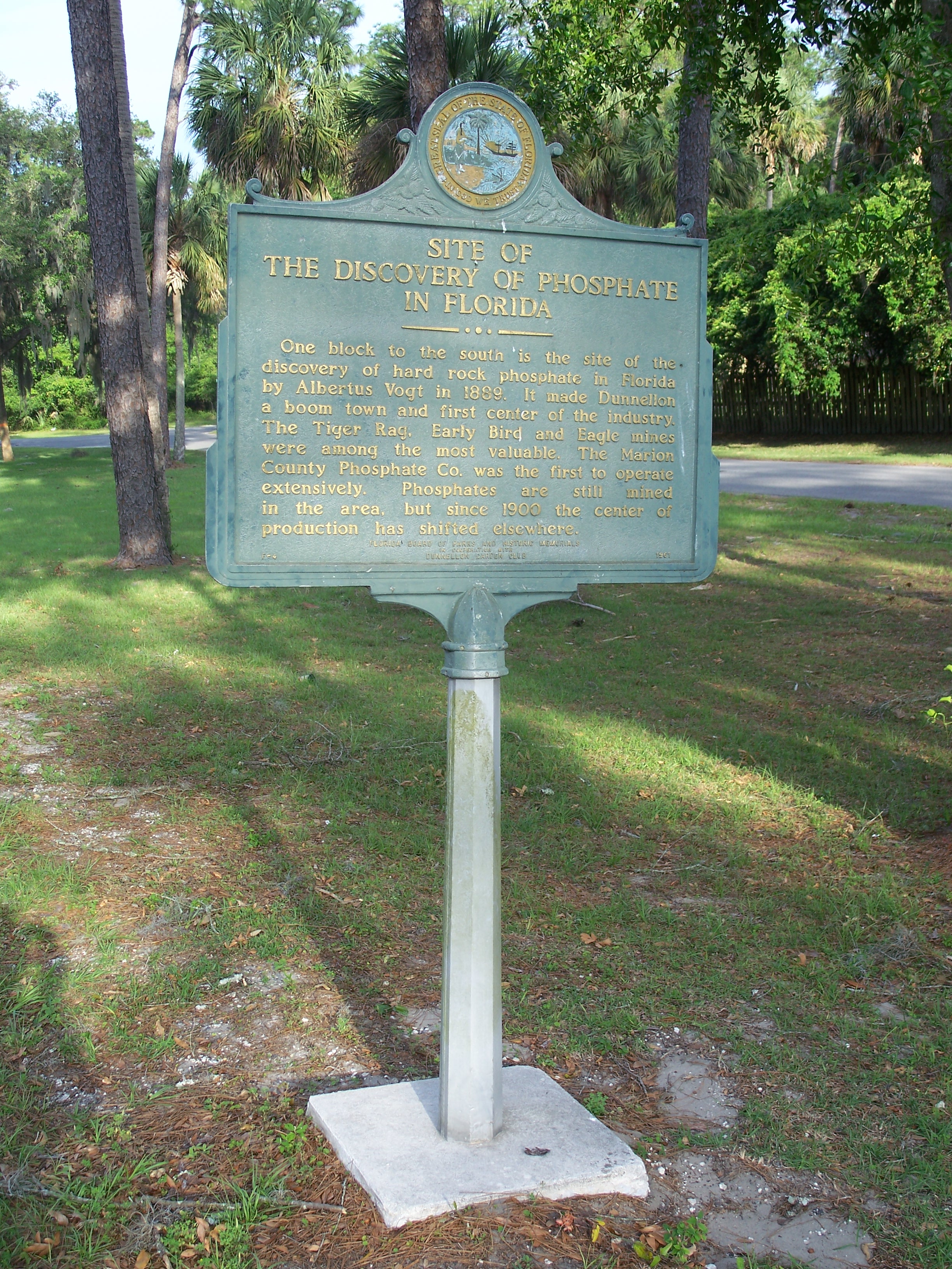
After the discovery of hard rock phosphate by Albertus Vogt in 1889, Dunnellon became a boom town, expanding until the early 1910s. The remnants of that time can still be seen along the driveway to Rainbow River State Park:
Phosphate - The Mineral
Phosphates are the salts of phosphoric acid. The name phosphate specifies the inorganic anion (negative ion) PO43- that can establish ionic bonds to cations (positive ion). In this form, phosphorus has the oxidation number V.
Phosphates are the main minerals containing phosphorus. The most common ones are:
 |
 |
 |
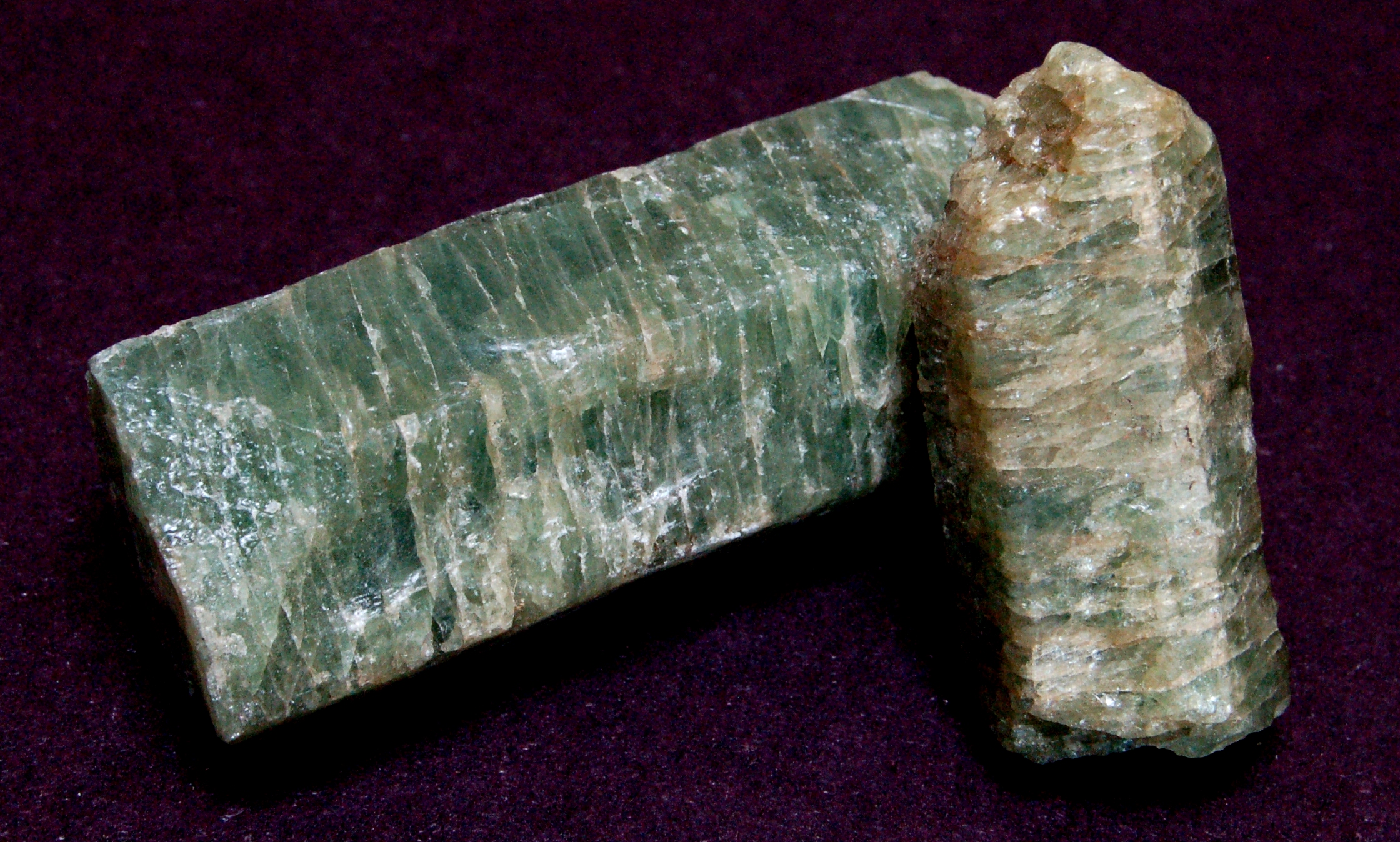
| Apatite Ca5(PO4)3(F,Cl,OH) |
Vivianite Fe3(PO4)2·8(H2O) |
Wavellite Al3(PO4)2(OH,F)3·5H2O |
Hydroxylapatite in a modified form makes 50% of the bone material and is therefore known as the bone mineral. This way, artificially synthesized hydroxylapatite is commonly used to replace amputated bones or as a coating to promote bone ingrowth into implants.
Phosphate rocks are mined because they are the main source for phosphorus, which is needed in agriculture and the industry. One of the largest phosphate deposits in North America is the Bone Valley region in Central Florida, south of Dunnellon. The use of phosphates as an agricultural nutrient makes them a valuable good, becoming more and more expensive as natural resources are about to run low while the population increases. It is likely that the remaining phosphate deposits will be used up even before the last oil resources.
Most deposits originate from former ocean sediments. This so called phosphorite mainly consists of fluorapatite but hydroxylapatite is also present. It usually comes in layers with the thickness of some centimeters up to several meters. These layers not only contain the pure phosphorite but also limestone and organic residuals. Fossils are commonly found within these formations as well. The phosphorite formation and accumulation can be described by the phosphorus cycle: Dissolved phosphorus is brought into the ocean by rivers. Here it is processed by micro- and macro-organisms. The processed phosphorus is then taken up and accumulated in teeth and bones of certain fish and later deposited on the ocean floor. Phosphorus can then be released from the sediment depending on the pH and salinity levels of the water.
Usage of Phosphate
Phosphate rocks are hardly soluble. To be used as a fertilizer, they have to be chemically digested, usually with sulfuric acid or phosphoric acid. When done with sulfuric acid, the result is superphosphate: monocalcium phosphate mixed with calcium sulfate (gypsum). Calcium sulfate is hardly soluble. When digested using phosphoric acid, the formation of calcium sulfate is avoided and only monocalcium phosphate is formed: triple super phosphate.
Another use of phosphates is in laundry detergents. In form of sodium triphosphate it is used as a water softener and can comprise up to 50% of the detergent.
In both cases, the use as a fertilizer and the use in detergents, the environmental effects of the overuse of phosphate leads to crucial environmental problems. If more phosphate is brought on the field than can be taken up by the plants, the rest is washed out into the surrounding waters. This leads to eutrophication of the affected waters.
Rainbow Springs State Park
When the Blue Spring area (known as Wekiwa Creek by the Seminole Indians) was developed as a tourist attraction in the 1930s, it's name was changed to Rainbow Springs because there have already been several springs named "Wekiwa" or "Blue". In the 1970s the tourist attraction was forced to close and in 1972 the entire Rainbow River was designated as a Registered Natural Landmark. Today, the beautiful spring and nature can be visited again.
There is a swimming and picnic area. You can go for a hike, snorkel or just enjoy the nature. Camping is also available.
For opening hours and fees visit the official park website.
The Cache
This cache was placed with permission of the park management. To make the cache hunt a pleasant activity for everyone, please observe the park rules. The answers for this cache can only be found when entering the park and are therefore only available during the opening hours. A park fee of $2 is required. Opening hours are from 8 a.m. until sundown.
Please answer the following questions:
FIELDWORK
1. When approaching the parking area, you can see the old phosphate pits to your left. When did the phosphate industry in this area reach it's peak according to the sign?
2. Try an estimate of the size of this pit. The distance to the farest wall you are facing is enough.
3. Rainbow springs features two beautiful waterfalls, both remnants of the time as a tourist attraction. In which of them, soil from a nearby phosphate pit was used?
4. "The water cascades approximately 60 feet to create ______ falls." What is left out?
HOMEWORK
5. What is the name of the natural organic chemical, in which phosphate plays a very important role to deliver energy for bio metabolism -> currency of intracellular energy transfer.
6. What is the chemical formula of phosphate in strongly acidic condition.
Please send us the answers prior to logging the cache.
Optional: We would like to see a picture of you taken either in front of the Phosphate Pit or one of the waterfalls in your log.
Have fun exploring the park and enjoy your stay!
PrefixLookupNameCoordinate PK PARKNG GC2PY5H Parking (Parking Area) N 29° 06.305 W 082° 26.310 Note: You can park here to enter the park area.
![]() Bilder
Bilder
![]() Hilfreiches
Hilfreiches
 Suche Caches im Umkreis:
alle -
suchbare -
gleiche Cacheart
Suche Caches im Umkreis:
alle -
suchbare -
gleiche Cacheart
 Download als Datei:
GPX -
LOC -
KML -
OV2 -
OVL -
TXT -
QR-Code
Download als Datei:
GPX -
LOC -
KML -
OV2 -
OVL -
TXT -
QR-Code
 Mit dem Herunterladen dieser Datei akzeptierst du unsere Nutzungsbedingungen und Datenlizenz.
![]() Logeinträge für The Rainbow Springs Phosphate Pit
Logeinträge für The Rainbow Springs Phosphate Pit
![]() 0x
0x
![]() 0x
0x
![]() 0x
0x