| Language: |


|
Country: |


![]()
GSM
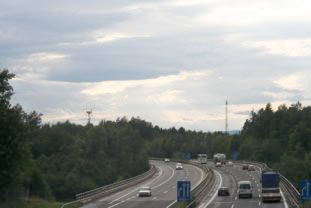
Multicache in der Region Ost-Steiermark. Bei manchen Stationen ist es ein Drive-In, bei anderen darf man sich schon auf
by DanTrack
 Austria > Steiermark > Oststeiermark
Attention! This Geocache is "Archived"! There is no physical container at the specified (or to be determined) coordinates. In the interest of the place it should not be necessarily to search!
|
|
||||
|
|||||


 Size: normal
 Status:
  Hidden on: 22 August 2005
 Also listed at:
  7 Found
 0 Not found
 1 Note
 0 Watchers
 0 Ignorers
 161 Page visits
 0 Log pictures

![]() Description
Deutsch
(German)
Description
Deutsch
(German)
Multicache in der Region Ost-Steiermark. Bei manchen Stationen ist es ein Drive-In, bei anderen darf man sich schon auf nen kleinen walk vorbereiten./p
Willkomen zum Geocache"GSM"
 |
Bei diesem Cache gilt es ein bisschen zum Thema GSM in Erfahrung zu bringen, um dann - in the wild - durch Besuche einiger BTSs (Base Transceiver Station) den Final-Cache zu finden. Der Cache (und auch die Sendemasten) befinden sich in der Oststeiermark - ich muss mich Cache-technisch einfach ein bisschen um mein Hometown kümmern.
|
Zum Aufwärmen gibts einen kleinen theoretischen Teil, wobei Google und Co recht hilfreich sein kann.
|
1942 wurde von einer
Filmschauspielerin und einem
Komponisten ein Patent zur sicheren Übertragung
von Steuerbefehlen für Torpedos angemeldet. Es fand damals jedoch
keinen großen Anklang. Das heutige GSM hingegen nutzt das (schon
freie, da das Patent abgelaufen ist) Verfahren zur Sicherung der
Übertragungskanäle. Heute nennt man es "frequency
hopping" |
H= |
|
Die Abkürzung "GSM" bedeuted heutzutage "Global
System for Mobile Communications". Das war aber nicht immer so. I = Buchstabensumme(erstes Wort davon) |
I= |
|
In einer Text-SMS-Nachricht können bis zu 160 Zeichen übertragen werden. J = Wieviel Bit Nutzdaten können übertragen werden? |
J= |
|
Bei GSM werden die Daten (Sprache, Steuerbefehle, etc) digital übertragen. Um die diskreten Werte über ein analoges Medium (Luft, in diesem Fall) zu übertragen, bedarf es eines Modulationsverfahren. K =
Buchtsabensumme(Welches wird bei GSM
benutzt?) |
K= |
Zur Überprüfung: Alle Ergebnisse sind ganzzahlig und positiv. Quersumme steht in den Hints.
Das
war nun die Aufwärmphase... jetzt gehts ab in die frische Luft!
Die oben angegebenen Koordinaten müssen nie besucht werden - sie
dienen nur als virtueller Referenzpunkt und wurden (fast) zufällig
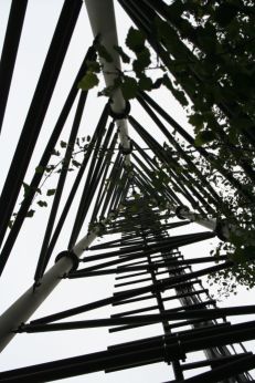
gewählt. In der Umgebung von diesem Punkt befinden sich 7 BTSs. Bei
jeder findet man einen Hinweis, der einem dem Cache einen Schritt
näher bringt.
|
Die Positionen der BTSs:
|
 |
Der Reihenfolge unterliegt keinem System und ist
auch nicht relevant. Man sollt die Punkte in etwa auf einer
Landkarte lokalisieren, um sich eine Route zusammentüffteln zu
können. Der Cache liegt irgendwo "innerhalb" des Gebietes.
Auch im praktsichen Teil werden sich ein paar Fragen zum Thema GSM
ergeben. Sind zwar nicht so schwer wie die obigen, aber sei
vorbereitet!
Ein Fortbewegungsmittel (Rad, Auto,...) ist sicher von
Vorteil - insgesammt ergibt sich eine Strecke von ca. 10km (je nach
Routenwahl).
Zu den einzelnen BTSs:
| BTS 1 |
Westlich vom Gebäude auf dem sich der Funkmast befindet verläuft eine Bahnstrecke. In der Nähe des Gebäudes ist eine Übersetzung mit einem kleinen Häuschen (für die Ampelanlage). Darauf befindet sich eine km-Angabe in der Art "km xxx.yyy" A = yyy-xxx (subtrahieren) |
A = |
| BTS 2 |
Diese befindet sich neben der A2 - man sollte sie aber nicht von dieser aus besuchen. Es führt ein Asphaltweg, der in einen Feldweg übergeht, bis vor den Funkturm. B = im naheliegenden Gebüsch findet man eine Box mit Hinweisen zu B |
B = |
| BTS 3 |
Kleiner Abstecher ins Raabtal. C = Befrage einen der Steine danach |
C = |
| BTS 4 |
Hier stehen zwei Funkmasten fast nebeneinander. Dazwischen steht eine Firma. D = Buchstabensumme(Name der
Firma) |
D = |
| BTS 5 |
Wenn man mit dem Auto unterwegs ist, sollte man die letzten 500m
zu Fuß ereldigen. Der Funkturm steht wieder neben der A2 - diesmal
sogar bei einem Parkplatz. Man kann ihn aber nicht von der Autobahn
aus erreichen - also gilt es, einen Weg von ausserhalb zu
finden. E = Hinweise in der Box |
E = |
| BTS 6 |
Diese BTS ist auf einem Dach eines Hauses montiert. F = Hausnummer (nur die Nummer) |
F = |
| BTS 7 |
Diesen Masten findet man am Dach eines Bauernhauses. Südwestlich davon befindet sich ein Haus. G = Anzahl der Rohre die aus den zwei Kamine ragen. |
G = |
Ebenfalls alles ganzzahlig. Quersumme der Summe wieder in den Hints.
Anm.: "Buchstabensumme" bedeutet: jedem Buchstaben in einem Wort wird als Wert der Platz im Alphabet zugeordnet und alle werden summiert. Also A=1, B=2, C=3,..., Z=26.
Wenn
du alle Rätsel gelöst und die Werte aller Variablen bestimmt hast,
gehts auf in Richtung Cache!
Der finale Cache befindet sich bei den Koordinaten:
N 47° [B-A-H/2]' [C/(F*G)-19], [E+D-E/7]
E 15° [I/2+G]' [(J/(K+20))+12], [K+2]
Da in
diesem Gebiet der GPS-Empfang nicht recht gut ist, kann es sein
dass die Koordinaten nicht gar so genau sind. Deshalb noch ein
Hinweis:
In der Nähe befindet sich ein Hochstand. Von dem gehe 38 Schritte
in Richtung 150° (SSO). Dann solltest du vor einem hohlen, aber
nicht leeren Baumstumpf stehen. Thats it!
Orginaler Cache Inhalt:
GC-Cachenote (nicht entfernen)
Log-Buch (nicht entfernen)
Bleistifft (nicht entfernen)
Hinweis für geplanten Bonuscache (ebenfalls nicht
entfernen)
GSM-Sim Adapter (klein zu groß, Marke Eigenbau)
B-Free-Besserwisser
Tastatur eines prähistorischen OneTouchEasy
Viel Spass!
Within this cache you have to show a well
biased understanding about the GSM-System and cell-phones.
The cache is located in the east of Styria. To locate the final box
you'll have to visit 7 BTSs (Base Transceiver Station) in
the region to find additional hints.
The first part is a theoretical one - to push up your knowledge about GSM.
|
1942 a actress and a
composer wrote a patent for secure transmisson of
commands for torpedos. The todays GSM-System uses a related
technology called "frequency hopping". |
H= |
|
The Abbreviation "GSM" means "Global System for Mobile Communications". But in earlier days it had a different wording. I = Buchstabensumme(first word) |
I= |
|
A textonly-SMS can carry 160 letters J = How many Bit Data can be transmitted? |
J= |
|
To transfer discret signales (as in GSM) over an analog medium, you have to use a modulation. K =
Buchtsabensumme(Which one is used within
GSM?) |
K= |
Now you have to visit each BTS listed below, to get the remaining seven variables.
The positions of the BTSs:
BTS1 = 1.48km 201°
BTS2 = 0.67km 222°
BTS3 = 1.49km 237°
BTS4 = 1.15km 293°
BTS5 = 1.92km 56°
BTS6 = 2,1km 288°
BTS7 = 3.7km 82°
(In
relation to 47° 05' 49,29" N 15° 44' 42,90" E)
Even in the wild some questions about GSM may come up to you - so,
be prepared!
A car, bike, etc may be necessary - the distance between all BTSs
is aprox 10km.
Zu den einzelnen BTSs:
| BTS 1 |
Western of the building, which carrys the BTS is a railroad. In the near, ther is a little building (for the traffic light). On it you see a km-value with the format "km xxx.yyy" A = yyy-xxx (subtract) |
A = |
| BTS 2 |
Located beneath the A2 - but dont stop on it to search for the BTS :) B = near to the BTS is a Bush - there you'll find a box. |
B = |
| BTS 3 |
Search for the RF-Tower in the "Raabtal" C = Ask on of the stones for it! |
C = |
| BTS 4 |
Here you can find two BTSs nearly together. Between them is a areal of a company. D = Lettersum(name of it) |
D = |
| BTS 5 |
If you travel by car, you shuld do the last 500m by foot. Also
located near the A2 - also not reachable from it. E = Search the box! |
E = |
| BTS 6 |
This BTS is mounted on a rooftop. F = house number of it (only the number) |
F = |
| BTS 7 |
This BTS is located on a farm-house. Near this, you see a white building with two chimneys on it. G = Count the tubes towering out of it. |
G = |
"Lettersum" means: each letter gets a value according to its position in the alphabet and then sum it up. (A=1, B=2, C=3,..., Z=26.)
If you
got all of the variables, you can go for the cache!
It is located at:
N 47° [B-A-H/2]' [C/(F*G)-19], [E+D-E/7]
E 15° [I/2+G]' [(J/(K+20))+12], [K+2]
Because of the bad GPS-reception a additional hint: In the proximitry of the final coords, you shuld find a raised hide. 38 Steps into the dircetion 150° (SSE) should lead you to a stump. Go for it!
Initial Cache content:
GC-Cachenote (do not remove)
Log-book(do not remove)
Pen (do not remove)
Note for a planned Bonuscache (do not remove)
GSM-Sim Adapter
"B-Free-Besserwisser"
Keypad from a "OneTouchEasy"-cellular
Good luck!
An die Finder: bitte
bewerten
![]() Additional hint
Additional hint
![]() Decrypt
Decrypt
Dhrefhzzr(U+V+W+X)=frpumrua
Dhrefhzzr(N+O+P+Q+R+S+T)=rys
A|B|C|D|E|F|G|H|I|J|K|L|M
N|O|P|Q|R|S|T|U|V|W|X|Y|Z
![]() Pictures
Pictures
![]() Utilities
Utilities
 Search geocaches nearby:
all -
searchable -
same type
Search geocaches nearby:
all -
searchable -
same type
 Download as file:
GPX -
LOC -
KML -
OV2 -
OVL -
TXT -
QR-Code
Download as file:
GPX -
LOC -
KML -
OV2 -
OVL -
TXT -
QR-Code
 When downloading this file, you accept our terms of use and Data license.
![]() Log entries for GSM
Log entries for GSM
![]() 7x
7x
![]() 0x
0x
![]() 1x
1x
 17 March 2012
mic@
wrote a note
17 March 2012
mic@
wrote a note
Bitte bei Statusänderungen, die bei geocaching.com durchgeführt werden, auch immer hier den Status ändern. Analog zu GC setze ich den Status für diesen Cache jetzt auch auf "Archiviert".
mic@ (OC-Guide)
 23 September 2007
Schuhhirsch
found the geocache
23 September 2007
Schuhhirsch
found the geocache
Schon im Juli hab ich die meisten Stages abgefahren, aber mit dem Final gewartet. Heute, auf dem Weg vom Schwammerlklauben zurück nach Graz sind Lalex und ich hier vorbeigefahren. Weil wir keine Beschreibung mit der Hochsitzgeschichte mithatten, waren wir kurz vor dem Aufgeben, als wir die Box entdeckt haben.
In: Zahnrad
Out: nix
TFTC
09 May 2007
LonesomeConebag
found the geocache
Ha, endlich auch den letzten Cache auf meiner ersten Seite erledigt!
Nachdem ich in den letzten Tagen die einzelnen Stationen abgefahren bin, konnte ich heute den Cache heben und die Geocoin daraus retten!
Dem Cache geht es soweit gut. Nur das Logbuch ist etwas feucht.
TFTC
LonesomeConebag
Out: Coin
In: Karusell
12 December 2006
gebu
found the geocache
So, jetzt habe ich auch diese Altlast endlich abgebaut. Vorgestern gings im Dunklen nach der Arbeit ans Abklappern der BTS - sollte kein Problem sein dachte ich mir, diese Dinger sind ja schön beleuchtet... das hat bei einigen Stationen auch gepasst, nur Station 6 und 7 haben sich etwas länger gewehrt.
Bei Station 7 war dann auch Schluss - im Dunklen an die gefragte Rohranzahl zu kommen war ohne sehr auffälliges Verhalten unmöglich, also verschob ich den Besuch dieser Station auf den nächsten Tag. Bei Station 2 sollte man übrigens nicht das glauben, was in der wikipedia steht...
Heute hat mir der Owner dann die Koordinaten bestätigt und einem schnellen Fund im hintersten Riedelland stand nichts mehr im Wege.
in: GC - als Anreiz diesen anspruchsvollen und aufwändigen Cache zu machen.
09 August 2006
Pr3ach3rman
found the geocache
Gefunden!
Nachdem wir das letzte Mal wegen der falschen Formel irgendwo anders rumgeirrt sind, hat es heute geklappt. Der GPS Empfang ist wirklich sehr schlecht und wir sind gleich mal um über 100 m am Cache vorbeigeschossen ohne den Hochstand zu bemerken  dann war er aber doch schnell gefunden.
Einen Kompass dabei zu haben zahlt sich da schon aus. Alles in allem ist der GSM Cache eine tolle Sache.
IN: Ü-Ei
OUT: -
cu, Pr3ach3rman
---
ps: Alles ist in gutem Zustand
19 February 2006
cezanne
found the geocache
It was that long ago that I had solved the preliminary tasks that it took me a while to find my notes and the coordinates of the seven stages to be visited (I guess longer that it had taken to find the answers last August). For a long time I either did not find the time or the motivation to visit the 7 stages.
It was clear to me from the beginning that it would not be attractive to leave the car somewhere and walk the whole way. For a while I considered to do the cache by bike, but I neither was eager to first ride to Gleisdorf by bike not to go there by train and take by bicycle with me. Moreover, when I had a look at the route betweens the seven stages, it appeared to me that most part of the route would not be that attractive for a bike tour from my perspectice.
Hence I decided to split the cache up into two parts. Yesterday I visited some stages and today the remaining ones. The hideout of Stage 3 is indeed creative and must have caused quite some work. At Stage 2 the value B caused me some headache - I then determined B in an alternative way. Today when I met Gert at Stage 5, I asked him for his value of B which coincided with the value I had, but I needed his demonstration to understand how the value B can be obtained in a more conventional way than I did. Stage 5 was the biggest challenge for me - but not finding the box there, but finding a feasible way there. I gave up my first attempt although I found out later that if I had continued, I would have arrived at Stage 5. The second attempt failed again due to a fence (not the fence close to Stage 5, but a fence close to the area of the rest station at the motorway). Finally, I then drove to a place which I could have reached also much easier in a complicated way, left my car there and walked to Stage 5. (BTW: I do not quite agree with the statement that Stage 5 cannot be reached from the motorway - it can be reached on foot from the rest station Arnwiesen if one takes the right approach.) At first I could not see the green BTS tower, only the red-white one, fortunately, I knew that the green one must be there as well as I had seen it from the other side. As soon as I found the tower, it was easy to find the box. The task there was not posing any further problem for me.
So I returned to the car and started to calculate the coordinates of the final cache. Then Gert appeared who chose the same place to leave his car than I did, but who chose the much directer way to arrive there .... It is quite strange that we recently meet that often at caches. I recalculated the coordinates at least three times and also checked the sum of the variables with the hint as I could not believe my result. After obtaining the same result all the times, I decided to have a look at this set of coordinates. The reason why I was sceptical about the correctness was that in my understanding the cache is not located in the area defined by the stages. Anyway, my coordinates turned out to be correct and I even managed to find the right street leading close to the cache at the first attempt although I did not have a map of that area with me as I had expected the cache to lie somewhere else.
When I saw the raised-hide I started to become confident to be at the right place. Indeed, I soon found the cache. As the snow was that wet today, it was much harder than for the previous finders not to create too many tracks. I then decided to create some additional tracks leading to other places .... In any case, hopefully the tracks will melt away soon.
Thanks for this quite elaborately designed cache. I suggest to classify it as a mystery cache as preliminary work is required. What I liked is that all stages and the final cache are hidden in a logical way which allows quick finds without long periods of searching. What I did not like so much is the fact that the cache does not invite for a nice walk - one can of course walk the whole route or parts of it, but the route is not very attractive for walking, not even in Winter time. In any case, this cache served as a good possibility for me to drive to places where I have never been before and where I do not have some sort of driving instructions available.
In: TB WhiTeddy
03 February 2006
JulieWood_Rabat
found the geocache
Hallo miteinander
Eigentlich wollten wir heute Nachmittag den GSR weitersuchen. Nachdem aber von Gert ein neuer Cache vor unser Haustür war haben wir mit diesem Cache angefangen. Da trafen wir Wild-Wuggis der mit dem GSM weitermachen wollte wo uns nur mehr 2 BTS fehlten. Also ab Richtung Gleisdorf.
Die letzten Berechnungen gemacht und ab Richtung Cache. Nur irgendwie war dort kein Hochsitz. Nach kurzer telefonischer nachfrage doch noch einmal berechnet und zu den neuen Koordinaten gefahren und innerhalb von 5 Minuten den Cache gefunden.
Danke an unseren Limousinenservice (Wild-Wuggis) und an DanTrack für diesen schönen Cache.
No Trade
Angi & Martin
13 November 2005
K2MO
found the geocache
Uiuiui, das war wieder ein bisschen eine intensivere Cacherei, aber zum Glück (und Dank kleiner Unterstützung [;)]) doch noch gefunden. Hatte bei BTS6 und beim Final-Cache mit den Himmelsrichtungen so meine Probleme, ein gscheiter Kompass wird schön langsam fällig!
Aber der Cache ist wirklich super gemacht, mit ein paar verspielten Feinheiten, tolle Ideen, DanTrack, thx für den GSM-Cache, bin neugierig, was Du uns noch so lieferst!
TNLNSL, lg
K2MO