| Language: |


|
Country: |


 Germany > Baden-Württemberg > Ostalbkreis
|
|
||||
|
|||||

 Size: no container
 Status: Available
 Time required: 0:40 h
 Hidden on: 11 October 2021
 1 Found
 0 Not found
 1 Note
 1 Watcher
 1 Ignorers
 56 Page visits
 1
1 

| Infrastructure |


|
| Waypoints |


|
| Time |


|
| Seasonal |


|
| Listing |

|
![]() Description
Deutsch
(German)
Description
Deutsch
(German)
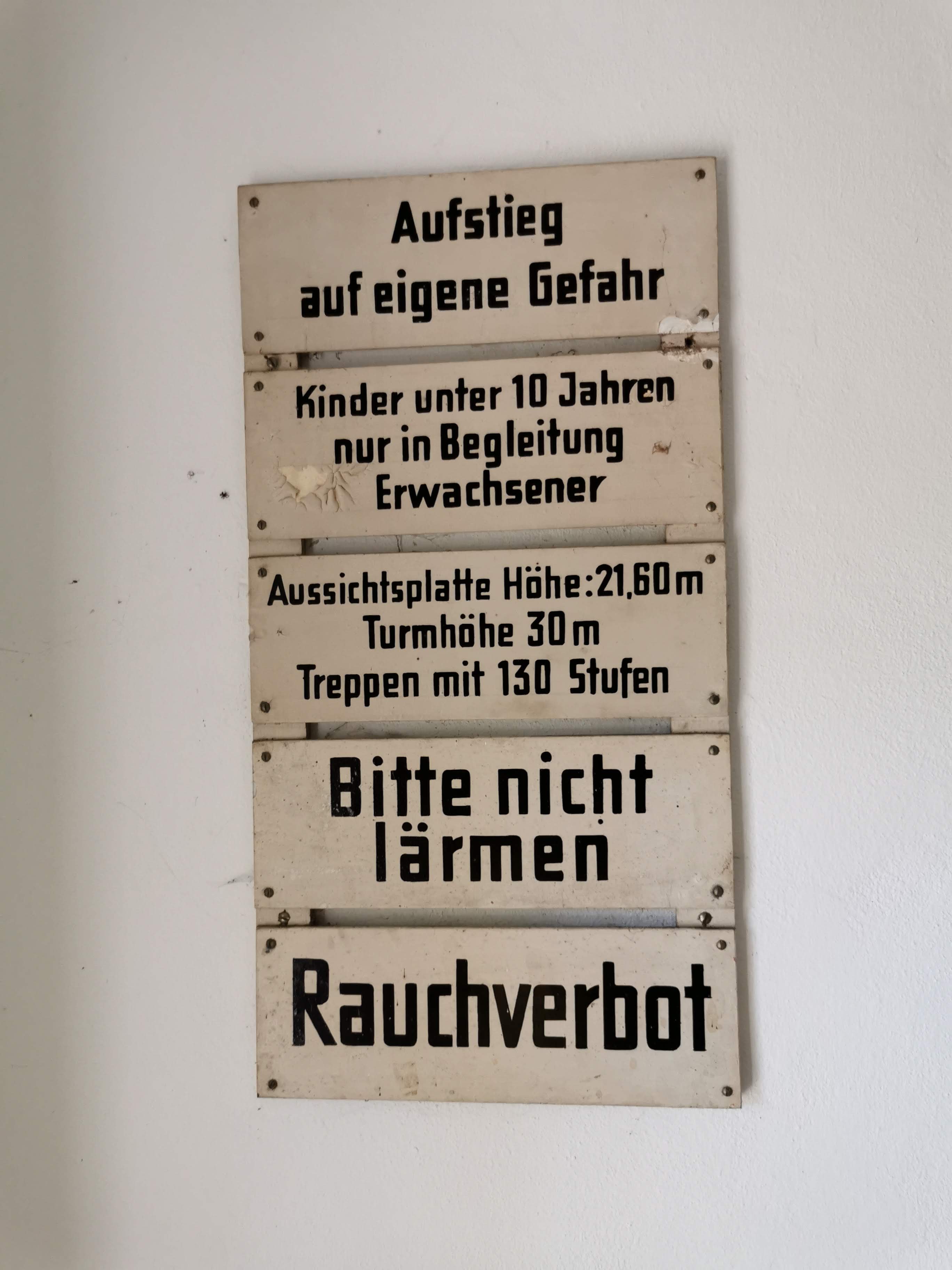
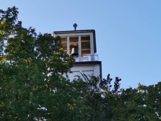
Das Mahnmal auf der Schillerhöhe wurde 1954 erbaut. Bis heute mahnt das Glockenläuten des Turmes an Frieden und erinnert an die vielen Toten des 2. Weltkrieges.
Logbedingung: Macht ein Foto auf dem Turm mit euch oder einem persönlichen Gegenstand mit der Glocke im Hintergrund. Fürs Loggen ist auch ein Passwort notwendig. Dieses findet ihr auf der Glocke, Ostseite unter dem Stadtwappen der Stadt Aalen. Komplett mit Leerzeichen!
Leider ist es nicht so einfach in den Turm zu kommen. Man muss den Schlüssel für den Turm im Limesmuseum holen. Dies ist allerdings problemlos gegen Angabe der Kontaktdaten möglich. Das Museum ist nicht weit entfernt, siehe Wegpunkt. Montags hat das Museum geschlossen!
 ;-)
;-)
 Additional waypoints
  Convert coordinates
|
N 48° 50.173' E 010° 05.044' |
Beim Limesmuseum erhält man den Schlüssel für den Turm |

 The additional waypoints are shown on the map when the cache is selected, are included in GPX file downloads and will be sent to the GPS device.
![]() Utilities
Utilities
 Search geocaches nearby:
all -
searchable -
same type
Search geocaches nearby:
all -
searchable -
same type
 Download as file:
GPX -
LOC -
KML -
OV2 -
OVL -
TXT -
QR-Code
When downloading this file, you accept our terms of use and Data license.
Download as file:
GPX -
LOC -
KML -
OV2 -
OVL -
TXT -
QR-Code
When downloading this file, you accept our terms of use and Data license.
![]() Log entries for Mahnmal Schillerhöhe
Log entries for Mahnmal Schillerhöhe
![]() 1x
1x
![]() 0x
0x
![]() 1x
1x
![]() New coordinates:
N 48° 50.076' E 010° 04.865',
moved by 15 meters
New coordinates:
N 48° 50.076' E 010° 04.865',
moved by 15 meters


 13 July 2022, 11:59
m_seni
found the geocache
13 July 2022, 11:59
m_seni
found the geocache
Heute wiedermal in Aalen und zum 2. Mal aufs "Mahnmal Schillerhöhe" gestiegen. Tolle Aussicht!
VIELEN DANK an Rex68 fürs Herführen. 🙂
![]() Original coordinates:
N 48° 50.081' E 010° 04.855'
Original coordinates:
N 48° 50.081' E 010° 04.855'