| Taal: |


|
Land: |


- Hoofdmenu
- Zoeken
- Maak een cache
- Beschrijving
- Toegestane HTML Tags
- My caches
- Bijzondere Caches
- Cache lists
- OConly-81


The Secret of Arnold S.
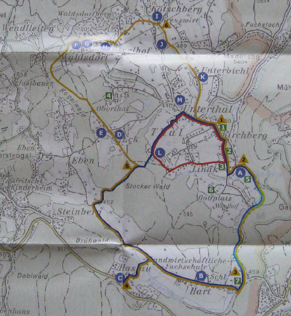
9km hike along a marked trail, approx 2.5 hours. Paved roads with low traffic volume, forest roads and trails.
door aj-gps
 Oostenrijk > Steiermark > Graz
|
|
||||
|
|||||


 Grootte: normaal
 Status: Beschikbaar
 Benodigde tijd: 2:30 h
 Verborgen op: 21. juni 2008
 Ook gepubliceerd op:
  8 Gevonden
 0 Niet gevonden
 0 Opmerkingen
 3 Volgers
 0 Negeerders
 143 Bekeken
 0 Log pictures

![]() Beschrijving
Deutsch
· English
(Engels)
Beschrijving
Deutsch
· English
(Engels)

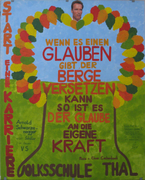
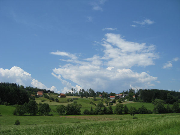
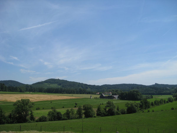
Enjoy a hike through a nice region and find out more about the life of this mysterious person.
Maybe you'll even find clues to the secret of his success?
Even if not, you'll find at least a geocache.
Approach
Car: There are parking lots available near the header coordinates where you can leave your car. If you come from Graz just drive to Thal, then turn left (uphill) right after the town sign.
Public transport: GVB bus #48 "Goesting - Thal" (schedule) until station "Thal-Kirchberg" or "Thalkreuz".
Bike: Bikeway R39 "Thaler Radweg". From Graz go north on the west side of the river mur until the R2 leaves the river bank. Then follow the signs R2/R39 west; you will pass a large InterSpar market. At a crossing not far from the header coordinates you have two possibilities. You can follow the street straight ahead towards "Thal" and then go to the header coordinates, or you can keep following the bikeway until you reach N47° 04.488 E015° 21.839. Here riding a bike towards the header coordinates is not allowed, but I still prefer to use this way than the main street to Thal. Note: While it's possible to ride a bike all the way along this cache there are quite some parts where this isn't allowed.
Now what?
At the header coordinates you will find a box with free maps of the hiking trail that we will follow - together with other interesting information about both the area and our mysterious person Arnold S.
Take one - it will be your guide!
We will follow the blue hiking trail. You will see blue arrows and blue marks along the way.
If there are no maps left you can print this one, but you will miss a lot of information. A full version is also available. In addition there is a single-page basic information sheet as well.
Stage 1 - Church
N 47° 04.584 E 015° 21.690
(Green point of interest #1 on your map)
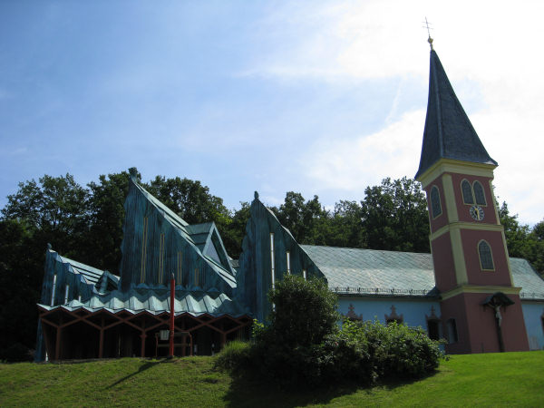
A really interesting church, right? It was designed by Ernst Fuchs, you can find more information in your guide (map) or online.
The rectorate was first mentioned in 1322 and was located at castle "Unterthal" (stage 2). 1772 the church was relocated to a chapel on a nearby hill. Because of the increasing population count the old church became too small and it was therefore rebuilt in 1992-1994.
How many red lamp posts with benches next to them are located around the place in front of the church? = A
Stage 2 - Ruin Unterthal
N 47° 04.359 E 015° 21.787
(Green point of interest #2 on your map)
This castle was constructed in the middle of the 13th century. One of the oldest parts is the tower with a wall thickness of more than 1.5 meters. The castle used to be the location of a church until it was moved to a nearby hill (stage 1). In 1996 parts of the castle were renovated.
Sum up all digits of the house number of the ruin (white tower) and multiplicate the result by 9. =B
Stage 3 - House of Birth
N 47° 04.329 E 015° 21.764
(Green point of interest #3 on your map)
Right next to the House of Birth there is another (yellow) building with an oval sign that tells us the name and purpose of this building. There is a single word (9 letters) in the middle, translate the first letter to a digit (A=1,B=2). =C
Update Jan 2013: The sign seems to be missing; it used to read "Reichsgräfliche herbersteinische FÖRSTEREI Thal", C=6.
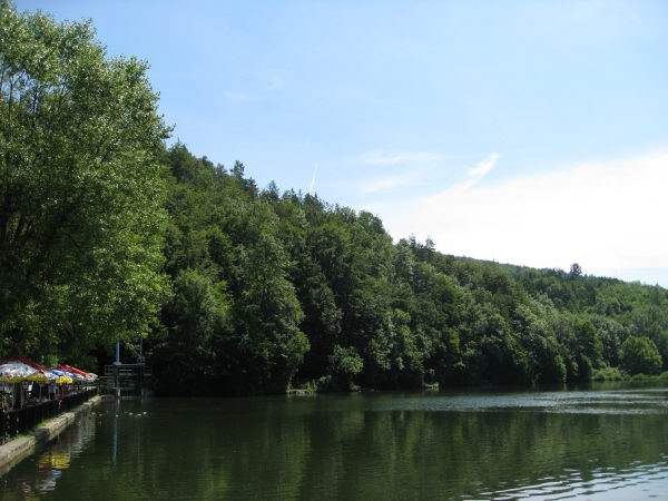
Stage 4 - Lake
N 47° 04.291 E 015° 21.979
(Yellow triangle #2 on your map)
This artificial lake was created in 1920 for the purpose of obtaining ice for cooling purposes. Five years later it was enhanced as a place of recreation by Hans von Reininghaus.
Right next to a large stone there is a post with two hiking signs. Sum up all digits on the first sign "Alt-Eggenberg". =D
Along the way
Stage 5 - Wayside shrine
N 47° 03.400 E 015° 20.722
(Near yellow triangle #4 on your map)
In which year was the construction of this object? 18EF =E,F
Along the way
I have added a trailhead waypoint at N47° 04.001 E015° 20.376 because it looks like this junction lacks a trail-sign. But you shouldn't be able to miss it with the trail-map anyway..
Stage 6 - Wayside commemorative cross
N 47° 04.185 E 015° 20.718
(In the forest on the way to yellow triangle #5 on your map)
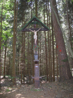
Date of construction. 19GH =G,H
Final stage - Cache
Follow the trail until you reach the stone at the yellow triangle #5 on your map. Take a seat and solve the following, really difficult calculation.
N47 0F.(E-G)(A+1)D
E015 20.(D+2)(B-C+2)(H-A-1)
Note: No multiplications.
There are spoiler pictures available. Take care - there are thorns near the cache location and the cache box!
Good luck.
Afterwards
You can just follow the blue trail back to the header coordinates. Or you can extend your walk and continue along the yellow trail and find out more about Arnold S.
I had planned to hide a traditional cache near castle "Oberthal" (green poi #4), but unfortunately it is on private property with no-entry signs.
![]() Hulpmiddelen
Hulpmiddelen
 Zoek caches in de omgeving:
alle -
zoekbaar -
zelfde cache soort
Zoek caches in de omgeving:
alle -
zoekbaar -
zelfde cache soort
 Download als bestand:
GPX -
LOC -
KML -
OV2 -
OVL -
TXT -
QR-Code
Download als bestand:
GPX -
LOC -
KML -
OV2 -
OVL -
TXT -
QR-Code
 When downloading this file, you accept our terms of use and Data license.
![]() Logs van The Secret of Arnold S.
Logs van The Secret of Arnold S.
![]() 8x
8x
![]() 0x
0x
![]() 0x
0x

 17. april 2022
Zoidberg73
heeft de cache gevonden
17. april 2022
Zoidberg73
heeft de cache gevonden
Im Rahmen einer Ostersonntags-Tour von uns abgeschlossen...
Bereits bei unserem letzten Besuch in Thal konnten die einzelnen Stages abgeklappert und die einzelnen Variablen bestimmt werden.
Heute besuchten wir den GZ und konnten die Dose sofort beim markanten GZ Objekt finden; Logging war problemlos möglich :-)
TFTC
25. april 2014, 15:00
na6azemlia
heeft de cache gevonden
TFTC
17. januari 2009
ferret out
heeft de cache gevonden
Das war genau das Richtige für einen sehr schönen Samstag Nachmittag.
TFTC
12. juli 2008
Rhodo Dendron
heeft de cache gevonden
Schöne Runde durch eine von mir ansonsten selten frequentierte Gegend. Alle Aufgaben waren problemlos zu lösen, der Cache ist tadellos in Ordnung.
TFTC NT
28. juni 2008
cezanne
heeft de cache gevonden
As I was busy with shopping obligations in the morning, I selected this cache as it has about the right length for an afternoon cache and is easily reachable by bicycle for me.
I went to Thal by first following the R2 (not a perfect idea I should have avoided the part through Augarten today due to a big party taking place there) and then the R39 bicycle path.
The church at Stage 1 is well-known to me. While it is an interesting piece of architecture, it is not a church of the type I feel comfortable with.
Having had a closer look at the map and the location of the stages to be visited, I decided to take my bicycle with me and to push it where cycling is not allowed or to use alternative routes.
Riding the bike had the disadvantage that sometimes I was too fast and realized to late that I had missed a turning. After a short detour I arrived at Stage 2. Due to my wrong routing decision I had passed Stage 3 on my way to Stage 2.
Stage 3 was the first Stage not yet known to me.
Stage 4 was again very familiar to me. Since I had my bicycle with me and since I know the route along the lake very well, I decided to follow first the road and then the bike path leading to the sports centre in Thal. From there I continued to the school Grottenhof Hart. There I realized that I had entered wrong coordinates for Stage 5. I then corrected the coordinates, but nevertheless I again missed a turning due to being to fast and due to having the GPS in my knapsack. After another look at the map and a small detour I arrived at Stage 5. Since I knew that I had to get back to the crossing from there the path leads up to Stage 5 anyway, I left my bike at the crossing. I would not have included this stage into the hiking trail - it appears somehow artificial to me.
After having arrived back at my bicycle I continued by bike until reaching the waypoint where one has to leave the road leading to Thal-Eben. From my point of view the part of the trail from this point until Stage 6 and further on to cache is the nicest part of the whole trail for hiking. The other parts are nicer for riders of bicycles. Even if riding a bike would be allowed in this section of the trail, it would have been possible for me with my bicycle. Today some parts were quite muddy and at one point the trail was blocked by a fallen tree and it was not easy for me to circumvent this obstacle with my bicycle.
The reception in the forest was very bad - sometimes I had no reception at all. Nevertheless, I managed to reach Stage 6. I determined the coordinates of the cache right at Stage 6 and then continued to the cache. Fortunately I found the cache soon despite the fact that I had forgotten the spoiler pictures at home. The reception was very jumpy, but the hideout is a characteristic one which is not easy to overlook.
From the cache I continued along the blue trail. Soon I reached a road where I could ride my bicycle again. I refrained from revisiting Stage 1 and went directly to Gösting without passing the lake again.
Overall I enjoyed this cache even though Arnold S and his life do not interest me at all. In any case I spent a nice time outside and the weather was beautiful and not too hot. Thank you for hiding this nice cache.
Out: TB