| Langue : |


|
Pays : |


| Suivez-nous : | |||
| Contact us: | |
| Rejoignez les discussions : | ||||
|
|
Forum d'Opencaching | |||

|
Groupe Facebook | |||

|
GitHub | |||

|
Slack | |||

 France > Basse-Normandie > Calvados
|
|
||||
|
|||||

 Taille : aucune boîte
 Statut : disponible
 Temps nécessaire : 0:20 h
 Caché en : 26. octobre 2022
 0 trouvé
 0 pas trouvé
 0 Remarques
 0 Observateurs
 0 Ignoré
 14 Visites de la page
 0 Images de log

| Infrastructure |


|
| Waypoints |

|
| Saisonnier |


|
| Inscription |

|

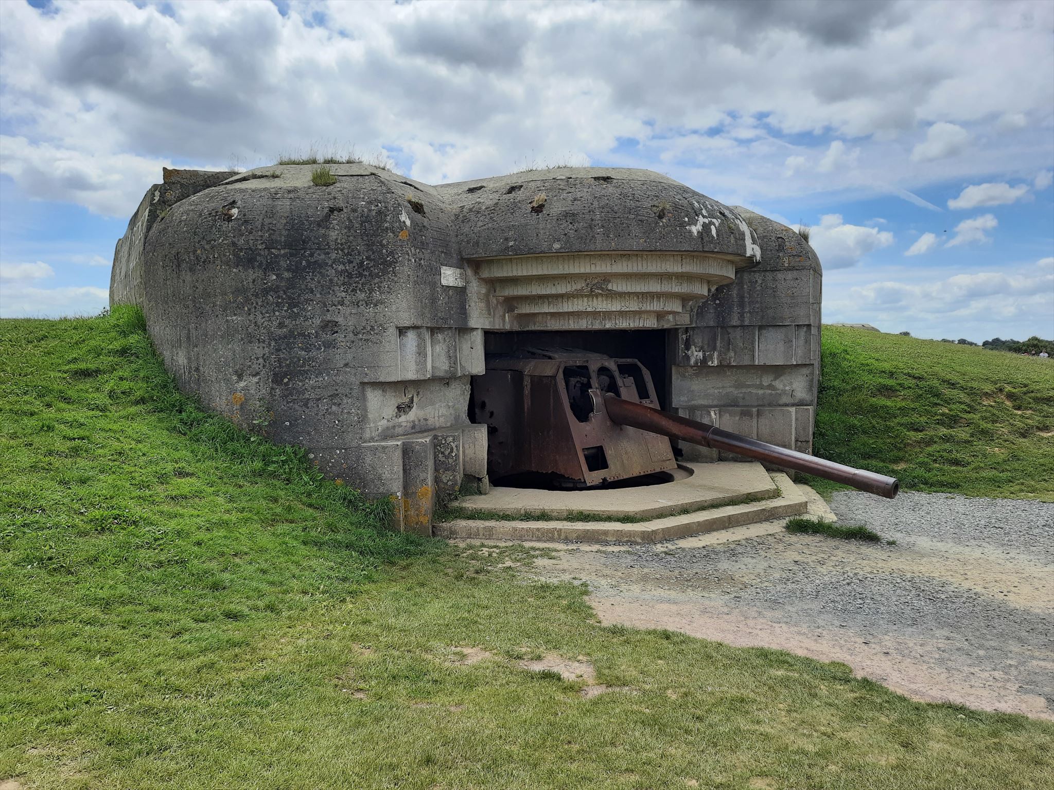
This earthcache will show you dripstones in a former German bunker from World War II. (For historic information see Longues-sur-Mer battery - Wikipedia).
Stalactite is a term for a specific type of stalactite, which can occur in limestone caves or hanging under calcareous rock. They are formed by each drop depositing a vanishingly small amount of limescale, variation in water flow and air flow determines shape and how slowly they grow. If the water, for example, is also ferrous, it can give a rust-yellow color.
A stalactite is a pin that grows or has grown down from the roof, as opposed to a stalagmite that grows up from the floor.
Stalactites are formed by deposition under limestone, as lava, as ice and under (artificial and natural) cementitious structures and rocks.
Limestone stalactite is formed by the deposition of calcium carbonate and water reacts with the surrounding air. The deposition rate is very slow about 0.1 mm / year.
Lava stalactite is formed by liquid lava and forms very (geologically) rapidly. These can be formed in hours-weeks.
Ice stalactites or icicles are for example well known in Norway and are formed when water freezes to ice, very quickly within hours.
The stalactite at GZ is of the cement stalactite type. This type of stalactite is formed as there is calcium oxide in concrete and cement. This calcium oxide reacts with water that penetrates the concrete and forms a solution of calcium hydroxide.
CaO + H2O → Ca(OH)2
When the water with this calcium hydroxide has penetrated the structure and comes into contact with air and a new chemical reaction takes place when the calcium hydroxide reacts with the carbon dioxide in the air. And we get the resulting calcium carbonate that forms the stalactite.
Ca(OH)2 + CO2 → CaCO3 + H2O
Send the answers to the questions via my profil. Attach your picture to your online-log, not to the message. Logs without prior answers to the questions or the required picture will be deleted without notice.
Your tasks at waypoint 01:
1) How long are the stalactites and how thick in diameter?
2) How long are the stalagmites and how thick in diameter? Are there any?
3) Explain the difference between 1) and 2).
4) Does the stalactites are at specific structures at the ceiling? Yes (which?) or no?
5) Which colours have the dripstones? Is iron involved in the coloring?
6) Based on the fact that the bunker was completed in April 1944, what is the max growth rate in mm/yr for the observed stalactites?
7) How does the answer in 6) compare to the growth rate of a typical limestone based stalactite?
8) Upload a photo in your online-log of your GPSr or you or parts of you or your nickname written on a paper... which shows you together with a canon at one of the three other bunkers (see waypoints 02, 03 or 04).
 Des waypoints supplémentaires
  Autres systèmes de coordonnées
|
N 49° 20.619' W 000° 41.661' |
02 Fotopoint | ||
|
N 49° 20.613' W 000° 41.723' |
03 Fotopunkt | ||
|
N 49° 20.594' W 000° 41.779' |
04 Fotopunkt | ||
|
N 49° 20.565' W 000° 41.518' |
Parking area |


 Les autres points de passage sont affichés sur la carte lorsque le cache est sélectionné, sont inclus dans le téléchargement de fichiers GPX et seront envoyés à l'appareil GPS.
![]() Utilités
Utilités
 Chercher des géocaches prés:
tous -
trouvable -
même type
Chercher des géocaches prés:
tous -
trouvable -
même type
 Télécharger en fichier :
GPX -
LOC -
KML -
OV2 -
OVL -
TXT -
QR-Code
Lors du téléchargement de ce fichier, vous acceptez nos conditions d'utilisation et la licence de données.
Télécharger en fichier :
GPX -
LOC -
KML -
OV2 -
OVL -
TXT -
QR-Code
Lors du téléchargement de ce fichier, vous acceptez nos conditions d'utilisation et la licence de données.
![]() Logs pour Dripstones @ old German bunkers
Logs pour Dripstones @ old German bunkers
![]() 0x
0x
![]() 0x
0x
![]() 0x
0x