|
|
||||
|
|||||
| Infrastructure |


|
![]() Description
Deutsch
· English
(Anglais)
Description
Deutsch
· English
(Anglais)
 |
|
The formation of inland dunes In central Europe it was in the late Weichselian ice age about 10 degrees colder than today. There was therefore no forest cover and only a patchy vegetation cover in the form of the tundra. That offered little resistance to the winds. Lightweight,
fine-grained soil particles were collected by the air currents, often
for miles transported and re-deposited elsewhere. This gave rise over
time in many areas sand dunes. The dunes
were in strong winds in a position to wander. With the end of the ice
age, the activities of the dunes quickly came to a halt, as a result of
reforestation.
|
|
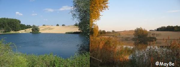
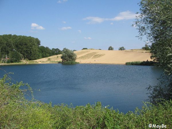
The Fuchsberg - a shifting sand dune The Fuchsberg is the last major shifting sand dune of the former ridge of mountains between Gerwisch, Heyrothsberge, Menz and Gommern on the "eastern Elbe-lower-terrace". It arose from the weichselian ice age, at the period from 150,000 to 10,000 years ago. Until late in time was the rearrangement of the sand carried by westerly winds. Thus, arised the steep north-east-hillside and the gently sloping south-west-hillside. |
|
|
|
Although the dune was already under protection as a natural monument since 1936, there was taken after 1945, a removal of large parts, as construction material for the reconstruction of the 2nd to World War destroyed neighboring city of Magdeburg. Its original height was formerly 70.3 m above sea level and it extended from north of the lake "Kulk" up to the Gommerner Salt Road. Today rises up the dune 20 meters above the lake "Kulk". The dune is now a protected habitat with the status of great value. (Source: wikipedia ) |
|
Log terms |
- Photo of you with GPS on the platform in front of the dune.
- In what direction extends the dune?
- Which lenght has the dune today?
- Which winds created the steep north-east-hillside and the gently sloping south-west-hillside?
Have fun exploring!
LG MayBe
![]() Utilités
Utilités
Cette géocache est probablement placé dans les zones de protection suivantes (Info) : FFH-Gebiet Elbaue zwischen Saalemündung und Magdeburg (Infos), FFH-Gebiet Binnendüne Gommern (Infos)
 Chercher des géocaches prés:
tous -
trouvable -
même type

 Télécharger en fichier :
GPX -
LOC -
KML -
OV2 -
OVL -
TXT -
QR-Code
 Lors du téléchargement de ce fichier, vous acceptez nos conditions d'utilisation et la licence de données.
![]() Logs pour Fuchsberg - Die Wanderdüne (EC)
Logs pour Fuchsberg - Die Wanderdüne (EC)
![]() 21x
21x
![]() 0x
0x
![]() 0x
0x
 30. mars 2023
Nitrobacter
trouvé la géocache
Auf meiner heutigen Heimreise nach Hannover sollte unterwegs doch unbedingt noch das ein oder andere Geocaching-Ziel besucht werden. Hier lockten mich zwei Earth-Caches nach Gommern, denn ich mag diese Cache-Art!
Vor Ort zunächst mal die beeindruckende Wanderdüne bewundert und erklommen und nachdem alle Fragen beantwortet waren sollte es im Gesteinsgarten weiter gehen 😇.
Vielen Dank fürs Zeigen dieses Naturphänomens sagt Nitrobacter!
 27. janvier 2022
vetusvir
trouvé la géocache
16:50 Uhr
Den Nachmittag habe ich für eine ausgedehnte Radtour genutzt. Von Magdeburg aus ging's nach Pechau, über den Klusdamm nach Vogelsang, von dort aus weiter nach Gommern und über Plötzky und den Deich der Umflutehle wieder zurück. 52 km attestierte mir das Navi am Ende der Tour, auf der ich für den ein oder anderen Fund gern vom Sattel gestiegen bin.
Der Gesteinsgarten, die Wanderdüne, der Kulk und der Aussichtsturm waren das Ziel meiner Radtour. Vom Aussichtsturm aus schob ich den Drahtesel über die Düne auf die andere Seite und umrundete so einmal den Kulk. Bei so viel Sand bekommt man glatt ein wenig Strandurlaubsfeeling. [8D]
Vielen Dank von vetusvir
 28. novembre 2020, 15:14
nikalatscht
trouvé la géocache
Voll schön hier!
Die Düne ist auch ein hervorragender Ort fürs Cross Action Adventure Minigolf 😂 dabei hatten wir leider einen Ballverlust im Schilf zu beklagen.
Der Ball ist neongelb. Wer ihn findet, kriegtn Fleiß-Bienchen und darf ihn behalten!
Lieben Dank fürs herführen!
 28. novembre 2020, 15:14
yoshilatscht
trouvé la géocache


 Allemagne > Sachsen-Anhalt > Jerichower Land


 Taille : aucune boîte
 Statut : disponible
 Caché en : 19. octobre 2009
 Inscription : https://opencaching.de/OC9057
 Aussi listé au :
  21 trouvé
 0 pas trouvé
 0 Remarques
 0 Observateurs
 2 Ignoré
 593 Visites de la page
 14
14 


