| Idioma: |


|
País: |


Through the Velebit mountains
A geological break
por GeoMops
 Croacia > Jadranska Hrvatska > Šibensko-kninska županija
|
|
||||
|
|||||


 Tamaño: sin contenedor
 Estado: disponible
 Tiempo requerido: 0:10 h
 Ocultos en: 26. agosto 2010
 También en la categoría de:
  22 encuentran
 0 no encontrado
 1 Nota
 1 Watcher
 0 Ignorado
 1569 Visitas
 8
8 

 Cache lists
| Infraestructura |


|
| Ruta |

|
| Waypoints |


|
| Tiempo |

|
| Estacionales |

|
| Necesita preparación |

|
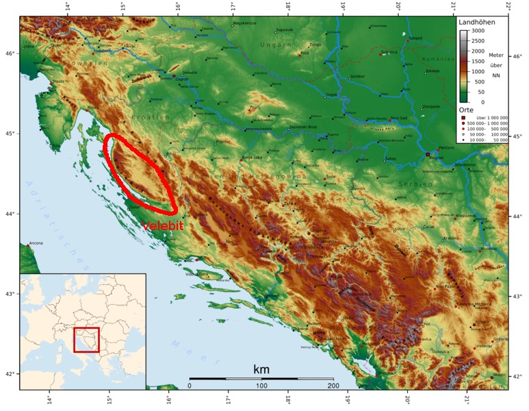 |
The Velebit mountains are 145km long and 10 to 30km wide. They are the longest part of the Dinaric mountain system between the Alps in the north and the Albanian Alps in the south. It is added to the Adriatic coastal belt of the Dinaric mountain folds, which are characterized by steeply rising, low-water coastal karst areas. The highest peak is Vaganski Vrh with 1757 m. |
|
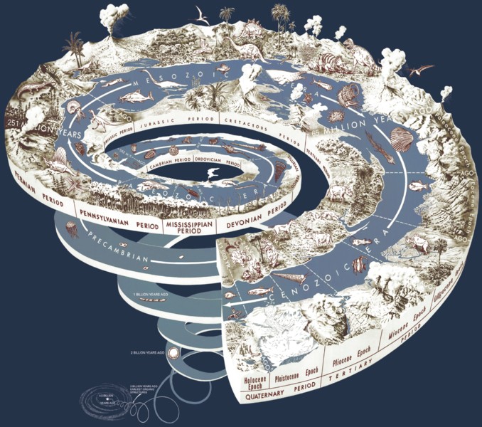
Since the Devonian (416 to 359.2 MBP), particularly in the Jurassic (199.6 to 145.5 MBP) and the Cretaceous Period (145.5 to 65.5 MBP), up to modern times were carbonate and dolomite sediments deposited in the lowering basin, which now reach a thickness of about 4km. The collision of African-Arab with the Eurasian plate since the Oligocene (33.9 to 23.03 MBP) folds the mountains (like the Alps). During the Quaternary ice ages, the Velebit mountain range was largely free of ice, so that their influence was low on the geological processes. |
 |
 |
Like the entire Dinaric mountain system, the Velebit mountain range consists mainly of limestone. Limestone is very porous and cracked the one hand, but also very hard and resistant to erosion. Water flows through the pores and cracks and chemically decomposes the limestone. The water, together with the carbon dioxide in air or sulfur compounds of the soil acids dissolve the calcium carbonate of the limestone. In this way, the enlarged pores and cracks become underground passageways. These events are the basis of karstification, which here in the outer Dinarides occurs particularly clear in appearance. |
|
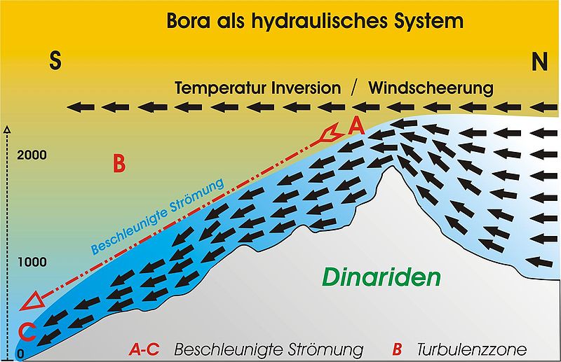
The Velebit mountain range is the source of up to Italy acting strong gusty, cold and dry Bora (Bura) winds. They form when cold continental air from the east reach the Adriatic Sea at the western slopes of the Velebit mountain range. The winds last in summer a few hours, in winter up to 14 days. The gusts reach particularly in transitional periods of spring and autumn speeds of more than 200km/h. For this reason, the A1 motorway between the Maslenica bridge and the Sveti Rok Tunnel is closed occasionally to prevent accidents. Here are unique in the world wind barriers tested, intended to permit traffic even in stronger winds. |
 |
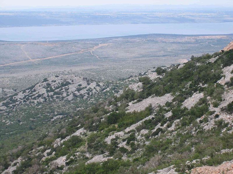 |
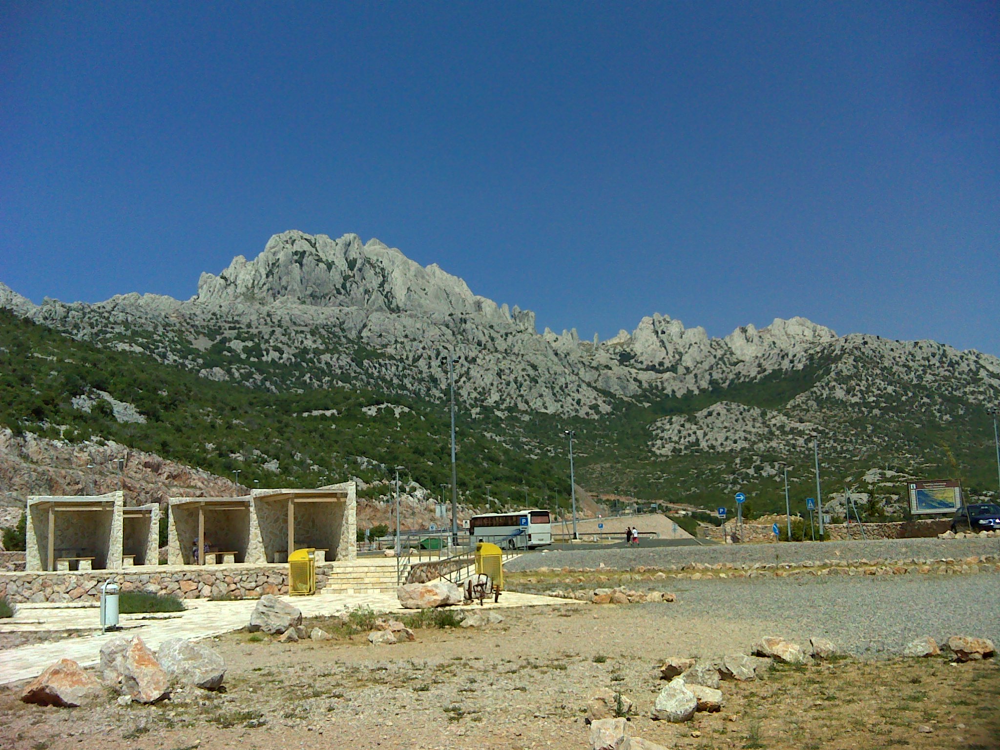
The eastern slopes of the Velebit Mountains are largely forested. The coastal side, however, is of very sparse vegetation. A characteristic feature of the landscape on the west side are bright limestone rocks , because the lack of bare soil. Due to the dryness of the Bora wind this side has very little water. Thus, on the basis of vegetation particularly clear, that the mountains separate two climate zones from each other, the mountain climate in the interior to the east and the Mediterranean climate on the coast in the west. The entire Velebit mountain is now a national park and protected area. |
|
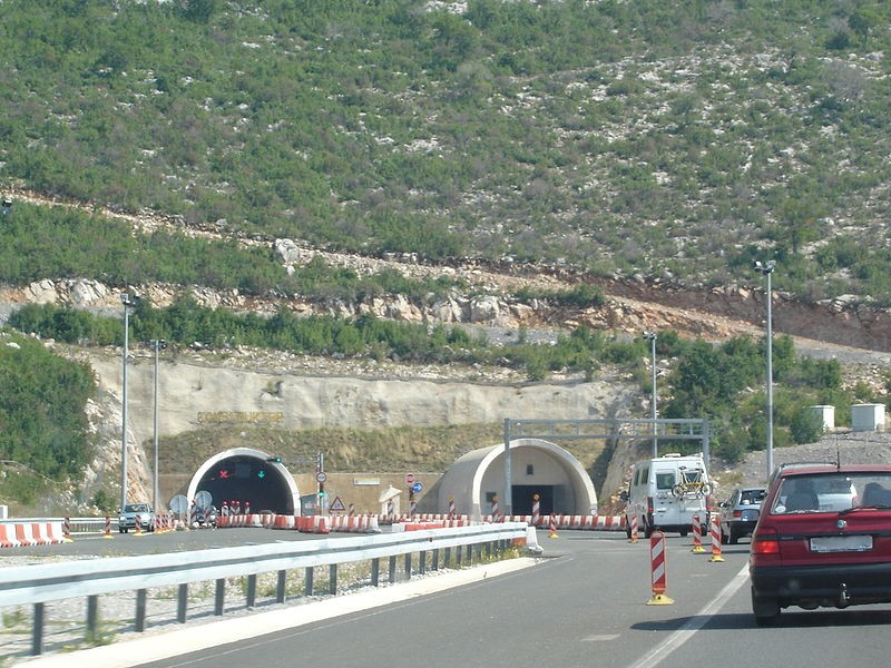
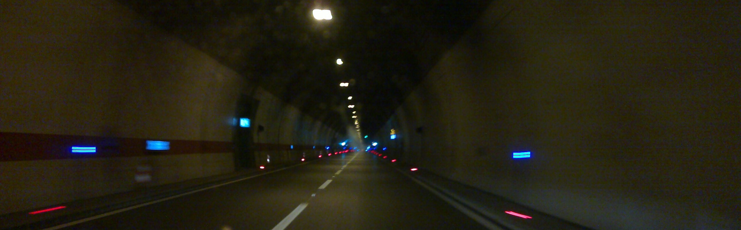
The Sveti Rok Tunnel connects on a length of 5.7 km the east and west side of the Velebit mountain range between the villages of Sveti Rok in the east and the west Maslenica. The construction was begun in 1993 and it was even promoted in the war. The first tunnel was opened to traffic in 2003, when both tubes were finished, the second tube in 2009. During the building large cave systems were crossed, which made the construction very complicated. After the Mala Kapela Tunnel Sveti Rok Tunnel is the second longest road tunnel in Croatia. The safety of both tunnels are among the most modern in Europe, so they are always rated very well in the relevant tests. |
 |
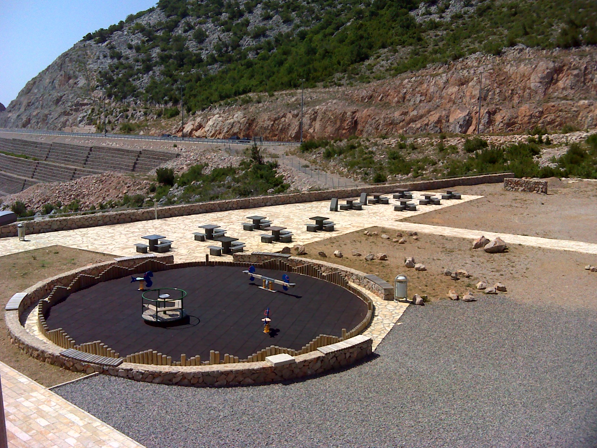 |
The location at the picnic area at Sveti Rok Tunnel offers a very nice overview of the bare peaks of the Velebit mountains, over its western flank and the flat coastal land with the Strait of Maslenica, to the islands. The tables and benches of the picnic area invite to a small break of the trip, and there may also the following questions be answered: |
-
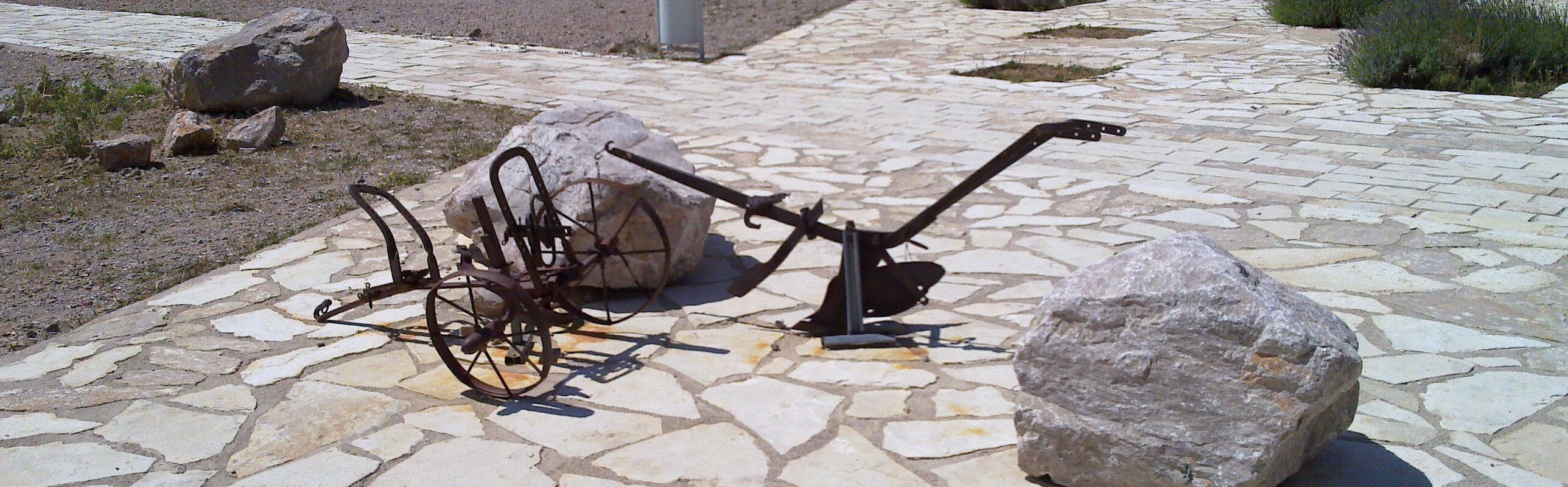
Of which rock are the tables at the picnic area at the cache coordinates built and how many different varieties of these rocks have been used?
-
In what year was the tunnel completed, that was opened to traffic in 2009?
To get the permission to log send an e-mail with your GC name in
the subject and a valid return address to:
<Rock>.<Number
Varieties>.<Year of
completion>@googlemail.com
For example
marble.2.2010@googlemail.com (these details are of course not
accurate).
If your information is accurate, the log permission will be
returned within a vew minutes.
I would appreciate a picture of you at the picnic area attached to your log.
Now I wish you a relaxing break, a lot of success in answering the questions and then of course a good trip!
Links:
English:
Sveti Rok
tunnel, Velebit
mountains,
Geology and speleology, A
Cavern found in Sveti Rok Tunnel
Hrvatski:
Tunel Sveti
Rok, Velebitski
masiv
Deutsch:
Sveti Rok
Tunnel, Velebit
Gebirge
All pictures were either shot by the author or acquired from Wikipedia, they are published under the "GNU Free Documentation License".
![]() Utilidades
Utilidades
 Buscar geocaches en las inmediaciones:
todo -
búsqueda -
mismo tipo
Buscar geocaches en las inmediaciones:
todo -
búsqueda -
mismo tipo
 Descargar como archivo:
GPX -
LOC -
KML -
OV2 -
OVL -
TXT -
QR-Code
Descargar como archivo:
GPX -
LOC -
KML -
OV2 -
OVL -
TXT -
QR-Code
 Al descargar este archivo, aceptas nuestros terminos de uso y Licencia de Datos.
![]() Log de entrada por Through the Velebit mountains
Log de entrada por Through the Velebit mountains
![]() 22x
22x
![]() 0x
0x
![]() 1x
1x
 26. junio 2023, 11:10
Tankred der Zweite
ha encontrado el geocache
26. junio 2023, 11:10
Tankred der Zweite
ha encontrado el geocache
Visited this fascinating place with Phanthalos on our way back from Croatia 😃
One table plate is missing, so we tried a few emails and only one did not return an error message?
Nonetheless we enjoyed the views and the really nice weather 👍🏻
Greetings from Austria 🇦🇹
PS.: In eigener Sache!
Mega-Event in Horn / Waldviertel
Sei dabei!
07. - 09.06.2024
Event: https://coord.info/GCA501G
Homepage: www.geow4.at
Fragen bitte an: info@geow4.at
 26. junio 2023, 10:19
Tankred der Zweite
han escrito una nota
26. junio 2023, 10:19
Tankred der Zweite
han escrito una nota

21. octubre 2019
broiler
ha encontrado el geocache
Today we went from Ciovo/Trogir to the Plitvicer Lakes and back.
Here we did a short break for answering the tasks before we really drove through (or under) the Velebit mountains.
Tftc,
broiler
04. septiembre 2019
aendgraend
ha encontrado el geocache
Heute sind wir nach unserem schönen Urlaub wieder Richtung Heimat gefahren, aber nicht, ohne vorher noch bei diesem herrlichen Aussichtspunkt vorbeizufahren.
Auf der Autobahn hoch war heute gar nichts los, aber der Wind war schon heftig. Auf dem Rastplatz angekommen, wusste ich dann auch, was der Bora bedeuten kann..
ALTA!!! [:O][:O]
Meine Autotür ging fast nicht mehr auf, und draussen konnte ich mich echt ziemlich schräg gegen den Wind stellen.
Die Aussicht konnte ich aber geniessen, weil es recht klar war, und sehr schönes Wetter.
Die Bilder von den Rastbänken habe ich noch schnell gemacht, dann sind wir auch schon weitergefahren, ein langer Weg lag noch vor uns.
Vielen Dank für's Herlocken - zu dem inaktiven Hotel, zu dem ausgebrannten Bus, zu der wunderbaren Aussicht!
[8)][^]
10. septiembre 2018, 10:58
Riedxela
ha encontrado el geocache
bei einer kurzen Rast habe ich diesen virtuellen Cache gut machen können. Leider ist das Hotel bzw das Restaurant schon ein lost place.
Die Lösungsmail wurde bereits bestätigt.
Vielen Dank sagt Riedxela.
am Rastplatz
